Over 160 lots located at Hailsham. Closing Sunday 27th September from 6pm.
Lot 86:
Description
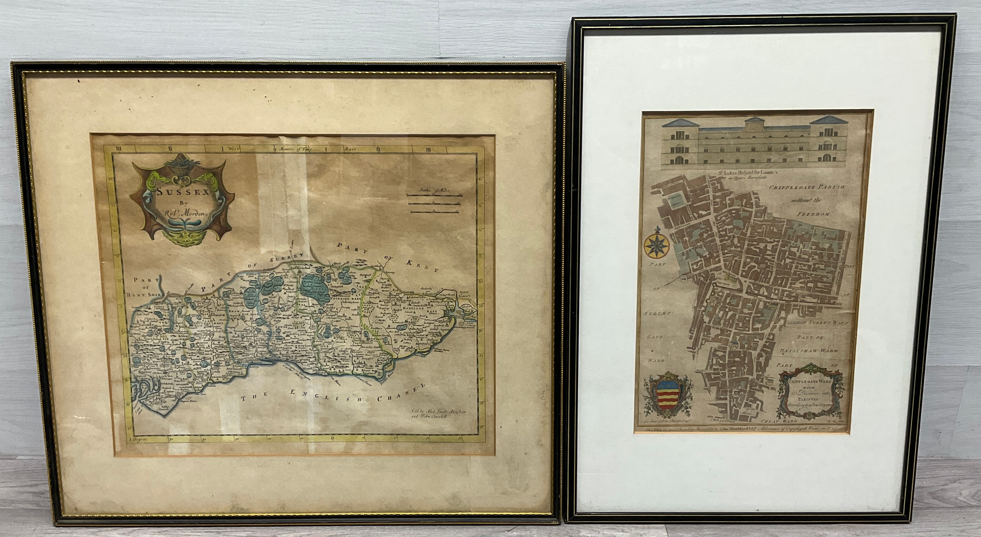
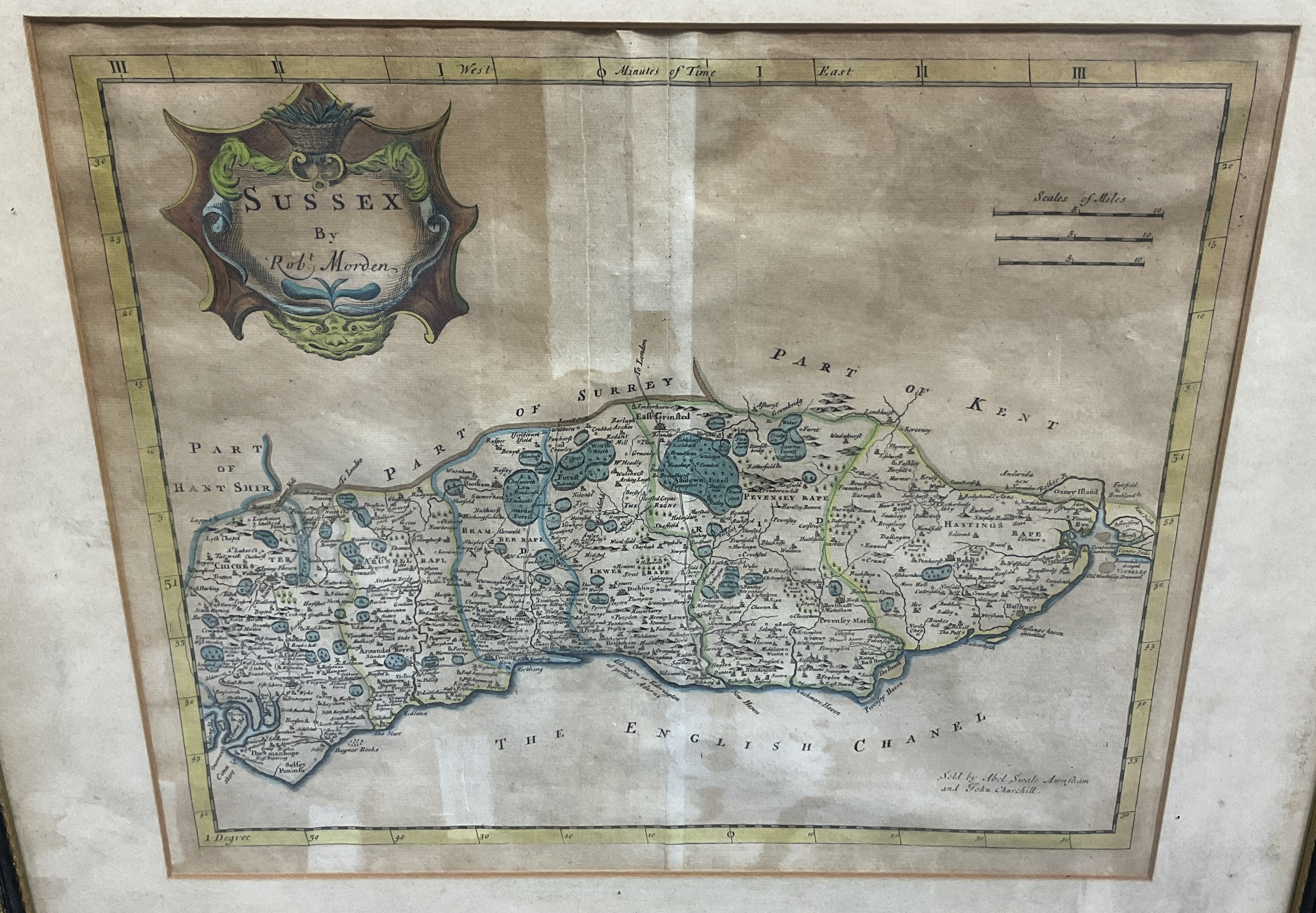
Two framed 18th-century hand-coloured copperplate engravings of British maps. The first print is a map of Sussex by Robert Morden, featuring a decorative title cartouche in the upper left corner with the text SUSSEX By Robt. Morden. The lower right corner bears the publisher’s imprint Sold by Abel Swale Awnsham and John Churchill. The county is divided into its six historical Rapes, Chichester, Arundel, Bramber, Lewes, Pevensey, and Hastings, delineated by coloured boundary lines.
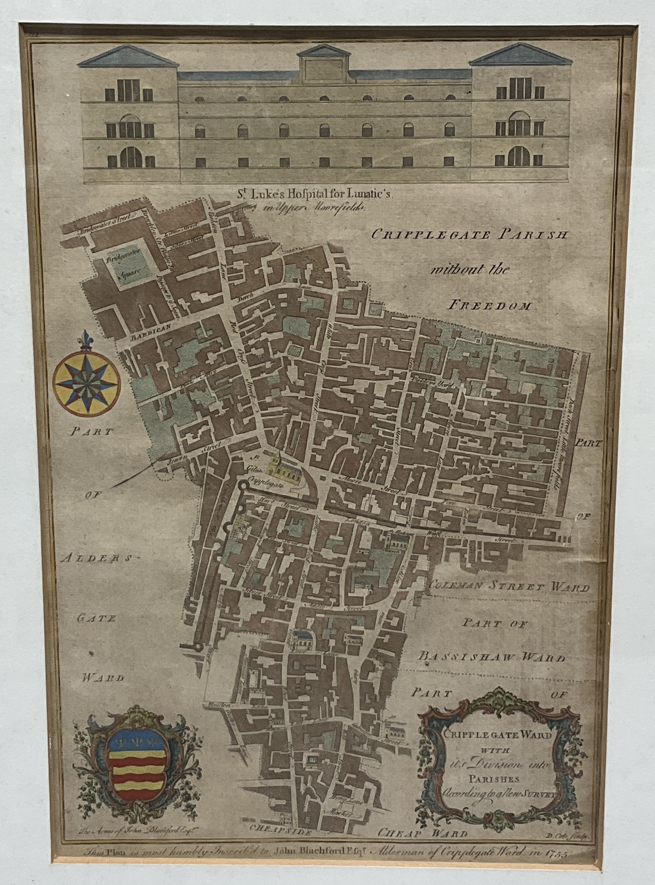
The second print is a ward map titled CRIPPLEGATE WARD with its Division into PARISHES According to a late SURVEY. The upper portion features an architectural elevation of St. Lukes Hospital for Lunatic’s in Upper Moorfields. A decorative coat of arms in the lower left is inscribed The Arms of John Blachford Esqr. and a dedication at the bottom reads This Plan is most humbly Inscrib’d to John Blachford Esqr. Alderman of Cripplegate Ward in 1755. The bottom right corner is signed B. Cole sculp. denoting the engraver Benjamin Cole. Both works exhibit visible plate marks. The Sussex map is housed in a gilt-edged black wooden frame with a cream mount, while the Cripplegate map is in a modern black frame with a white mount.
Condition report:
The Sussex map shows significant age-related toning, including a prominent vertical brown tidemark or staining running through the centre of the sheet (photo 3). There is scattered foxing and spotting across the paper surface (photo 3). The frame for this map shows light scuffing to the edges (photo 1). The Cripplegate map exhibits light toning and minor rippling to the paper (photo 2), but appears in generally stable condition.
Share this lot: